Tysons wants to transform into a bona-fide city. It won’t be easy.
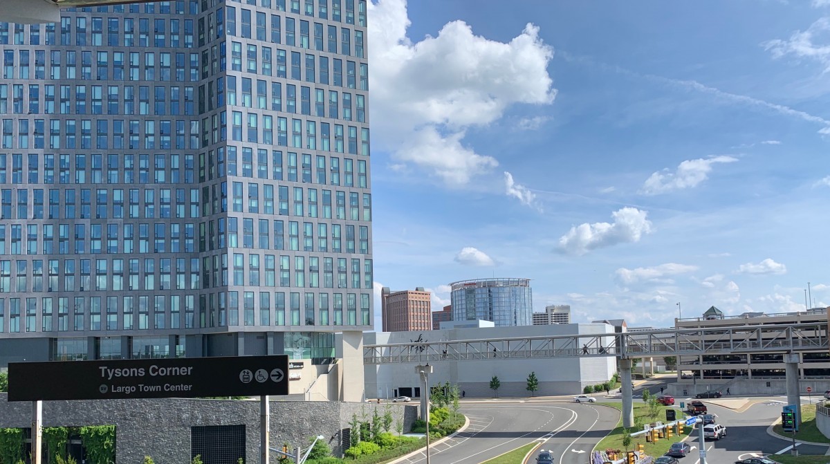
A view of Tysons from the Tyson’s Corner Metro Station by the author.
What would you do if you were tasked with doubling the number of jobs and raising the number of residents from about 14,000 people to 100,000 in a city? Plus you need to add 113 million square feet of new construction (for reference, Tysons mall is two million square feet). And that city needs to be a bustling urban center at all hours, complete with a walkable street grid, bike paths, and more—all by 2050.
That’s the challenge posed to Tysons, and to the many people vested in developing this four-square-mile “edge city” in Northern Virginia into a city in its own right. “It is an audacious experiment—and it still is an experiment,” says Sol Glasner, president and CEO of the Tysons Partnership, an association of business, civic, and government leaders dedicated to transforming Tysons into “a 24/7 live, work, play destination.”
Not that Tysons isn’t capable of big changes. In the 1960s this area was still farmland, and within a generation it catapulted itself into a business and economic powerhouse. Now five Fortune 500 companies including Booz Allen Hamilton, DXC Technologies, Hilton Worldwide Holdings, Capital One Financial, and Freddie Mac all have headquarters in the business district. Today it’s freqently touted as Fairfax County’s economic engine, and the median household income there is $91,230, compared to $61,400 nationally.
So Tysons has money and jobs. What it doesn’t have? A good street grid, for starters. Since the area grew up around highways, it’s not easy or pleasant for people on foot or other modes to navigate. Few people live there. They mostly flock to the area to work or to shop at its iconic mall, and leave when the sun goes down. It lacks civic culture; there are no places of worship within the city limits. To become a sustainable, modern city where people want to stay to live and play, you need a plan.
If you build it, will they come?
Tysons mushroomed in the 70s and 80s, a time when white people of means were leaving cities for the suburbs and increasingly driving to work. It was also the dawn of the age of the jet, which facilitated business travel and like the car, also incentivized sprawled-out development patterns. That car-centricity is built into Tysons’ very DNA, making navigating by foot or bike dangerous and unpleasant. Increasingly, planners realized that Tysons needed to prioritize transit and walkability.
In 1990, the Fairfax County Board of Supervisors began looking into how to transform the area from a business center into “the downtown of Fairfax County,” and created a 24-member task force comprised of local businesses, developers, and civic associations to help with the effort. They were very focused on extending Metro to Tysons, which they thought would help transform it into a more urban area.
With Metro increasingly more of a certainty, in 2005 the Board created the Tysons Land Use Task Force, and further defined its mission to evolve into an urban place. It updated the 1994 comprehensive plan with a new plan focused on building mixed-use development and more homes, especially around transit stops, and emphasizing walkability. They also wanted to create more amenities and give the place a face lift by adding more public art and parks. They also wanted to make the place more functional.
In 2010, the Board adopted a new comprehensive plan, which sketches the portrait of the vision for the future Tysons and guides decisions about the natural and built environment. It lays out six main goals for the endeavor:
- Create a people-focused urban setting
- Redesign the transportation network with a strong focus on transit
- Place a strong focus on the environment
- Develop a vibrant civic infrastructure
- Enhance Tysons as the county’s major employment center and regional economic engine
- Creating an implementation strategy
The comprehensive plan is essential for figuring out how to rezone an area or determining what requirements a property must meet in order to be built. Sharon Bulova, Chairman of the Fairfax County Board of Supervisors, played an integral part in moving it forward.
“When I was first elected in February 2009, the task force had been creating their vision,” Bulova said. “Then the next challenge was to translate that vision which is more conceptual and overarching into actual plan language. That is sort of where I came on board.”
Once the comp plan passed, things started happening quickly. “The very next day, seven rezonings were filed so that they could get approval that was in compliance with the new plan,” Bulova continued.
Approved projects in Tysons. Image by Fairfax County.
Stuart Mendelsohn, who now serves on the Board of Directors of the Tysons Partnership, held several titles during the early stages of Tysons. He served eight years on the Fairfax County Board of Supervisors, and on a number of regional transportation commissions, land use committees, and councils. He was a past Chairman of the Fairfax County Chamber of Commerce, and was also on the Tysons Task Force, which helped Tysons pivot towards being an urban center.
“The task force was set with the belief that we were going to get rail,” Mendelsohn said during a recent interview at the law offices of Holland & Knight where he practices land use, litigation, real estate, government affairs, and corporate law. “So we were optimistic that sometime in our lifetime we were going to get rail and therefore we needed to have a plan for when rail comes.”
Metro: “The spark that lit the fire”
In July 2014, four Silver Line stations opened to passengers—McLean, Tysons Corner, Greensboro, and Spring Hill—connecting the area to Metro, the third-largest rail system in the country. Glasner says a transit system was the key to driving change in the area.
“What’s different about Tysons, the spark that lit the fire, is the arrival of the Metro. And we can’t overlook that,” Glasner said. He says the county created the comprehensive plan because it knew the Silver Line was coming: “If the Metro weren’t coming, I’d say they’re be no there there.”
Transit shapes everything around it, and county wanted more of the city to be shaped around Metro, rather than the car, which is more sustainable and also better to walk in. It calls for more development around the stations in what it calls “transit-oriented districts”: Tysons West is near the Spring Hill station, Tysons Central 7 circles the Greensboro station, Tysons Central 123 is to the north and south of the Tysons Corner station, and Tysons East sprouts out of the McLean station.
Tysons' eight districts. Image by Fairfax County.
But in an area built around the car, are people actually taking the train? WMATA’s latest report shows ridership for the whole system through Q3 for 2019 was at 126.7 million trips – down 1.4 million from the prior year. The report site stated that the Federal shutdown and service disruptions for major capital projects may have caused some of the decreases. Indeed, when you look at the individual stations over the years, Greenboro, McLean, and Tysons Corner have all seen ridership tick up from 2015 to 2018.
Glasner said getting people onto Metro is vital for building an urban center. “It’s critical, and yet it takes time. The numbers are going up, but it takes time,” Glasner said.
The McLean Station. Image by the author.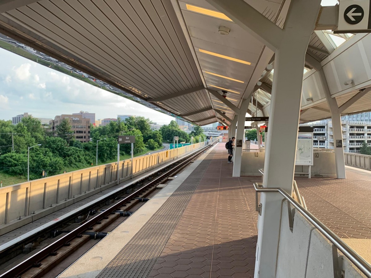
Transit is critical, but you need other things to draw people too. Besides transit access and walkability, that means amenities like green space and of course, art.
“We need to make sure that people are able to live in Tysons, and are able to have amenities” Bulova continued, “Each of the stations includes public art, and it was designed that way. It’s pleasant aesthetically, but it’s also a way-finding feature. So when you arrive at Spring Hill there’s art that lets you know yep, ‘I’m in Spring Hill.’”
To this end, Tysons is putting a lot of effort into building green space. It wants to build a “green network” of parks, including 20 athletic fields. The Tysons Partnership has commissioned massive murals around a popup beer garden near the Greensboro stop. It’s just one of many long-term, temporary amenities built in Tysons in an effort to get people to stay and linger.
A mural near the Greensboro metro. Image by the author.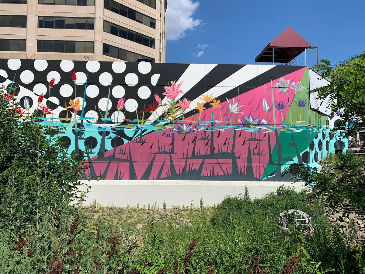
Does Tysons have all the ingredients of a city?
Since reshaping Tysons is such a daunting task, why not just stay a business center? And how will we know if the transformation is a success?
“You can’t put your toe in the water, you have to jump in,” Mendelsohn responded. “In order to have a 24/7 community where people work and play all in Tysons, I need more density, I need more activity centers, and I can’t get that unless you change the way we were going. So you needed to transform it.”
“I think it’s already starting to prove itself,” said David Schneider, an associate with Holland & Knight, and Chairman of the Tysons Partnership’s Emerging Leaders Council. “To this day you’re still seeing multi-million dollar rezoning come in, nine years after the plan was approved. It’s still being sought after 10 years after that. There is still momentum. We need to give Tysons that room to breath into that vision.”
Glasner says evaluating the accomplishments of Tysons requires a long view. “All these things are a slow build, and I measure it in decades,” he said. ”These are things that deepen within the passing of time.”
While the end date for Tysons’ transformation plan may be 2050, cities are dynamic things. We’ll continue to report on the growing pains as it seeks to make its abitious vision reality.
Check out part I of this series.
Correction: We have clarified that ridership for the whole Metro system was at 126.7 million trips, not for the four stations near Tysons.